A Bloody Good Walk
by Athol Abrahams
(From SUBW Logbook 3)
Party - Athol Abrahams & Dave Dash
Anzac weekend, 1966
Route: Kanangra Rd - Wooglemai Canyon - West Christys Creek - Cedar Valley - Chiddy Obelisk - Cambage Spire - Kanangra.
We reached the Boyd River at about 1 p.m. and bunked in, Rick and his Senior Scouts were nearby and the Rovers in Whalan's Hut. We had barely seen Kanangra weather so good.
"Better put up the tent, just in case," said Dave.
"It's not going to rain," said I.
At about 3.30 p.m. it began to pour. "I should've known better," I told myself as I crawled into Dave's tent, very wet and very sorry. At 6.20 a.m. Dave woke me and 10 minutes later, after cold porridge, we hopped into the Beetle and drove to the start of the Rover Trail. It was drizzling and utterly cold. We intended to go down Wheengy Whungee Canyon and had come prepared with two ropes. So, a mile or so later down the trail we took to the scrub and, although we couldn't see a thing in the mist, we hoped to find Wallara Ridge. About 5 minutes later we had succeeded in walking in a circle and found ourselves back on the trail. We didn't feel very determined in the cold and so continued down the trail towards Revelation Rock. It wasn't long before we were frozen stiff and sopping wet and on the whole not feeling very enthusiastic about anything - nevertheless we pressed on with Dave remarking "the weather's a bit bloody...!" There was silent agreement. At Revelation Rock we thought we ought to make some effort to sign the logbook - but in vain. With numb fingers, a crook pen, drizzling rain and not much patience the result was a big blue smudge with something like the heel of a boot in the top left corner.
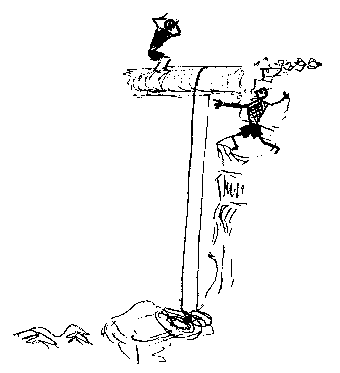
Having chosen Wooglemai as our effort for the day we blundered down the creek (where I succeeded in breaking my glasses) till we came to the first fall. I was told it was 120' but in the mist and rain we couldn't see the bottom well enough to judge. We put the ropes over a tree right beside the fall and Dave descended 25'. I let out 25' on one strand and tied it off at the top and he rapped down on the single strand. Rotten rocks were breaking off everywhere, their sound echoing up the canyon. "Rock's a bit bloody...!" was Dave's cry. One rope was 10' short at the bottom when the knot was brought back to the tree at the top. With a bit of fiddling and stretching of the rope I managed to reach the bottom with problems. We had a look at the next 40' drop. The belay, a log, was 30' away so we needed both ropes. While I was coiling the ropes Dave was investigating the next descent. Poking around amongst the stony bed he noted, "The belays around here are a bit bloody...!" I came along to help sort out the belay and I suggested the obvious choice - a log, 2' 6" or so in diameter protruding horizontally out over the drop. We finally the rope set up simply by walking out on the log with half the rope coiled in each hand and dropping the two coils. However, Dave looked under the log and found that you could walk down. So we did.
By now we were out of the mist and rain and we finally had the chance to thaw out a little. We continued down the creek, rock hopping most of the way, sidling three 25' falls before reaching the West Christys. In choosing to sidle the second of these falls we found ourselves faced with the descent of a rather steep gully filled well and truly with scrub. It wasn't the scrub so much as the 6' high stinging nettles at the bottom that caused Dave to hesitate. "If we don't go down here then we'll have to sidle round for hours," I pointed out. Dave was somewhat disheartened by the enormous nettles that grew over his head. He used his pack as a shield and pushed valiantly forward while I, in a cowardly fashion, brought up the rear. "Boy, these nettles are a bit bloody...!" was all I could get out of Dave. Once we started down West Christys we had little trouble. We sidled the first fall (Moxley Falls; 110') to the left and then (by Dunphy's nomenclature) sidled Barrier Falls (25'), and jumped down Shelf Falls (10' and 5). We abseiled Johnson Falls (80') on the L.H.S., then jumped the Brothers (5' and 10'), abseiled Log Falls (25') and climbed down Cavern Cascades (12-15'). There was possibly another fall after this which Dunphy calls Higgins' Falls (perhaps 8-10') but I can't remember. We took lunch on the Central Christys at 1.50 p.m. - it had been a long morning, about 6 1/2 hours. In the afternoon we wandered down the main Christy's Creek, did a hand-over-hand in Tagla Rift and camped the night at Cedar Creek on the Kowmung. We had just pitched the tent as the rain began again at 5.00 p.m.
We arose early on Sunday morning and again had a cold breakfast. Afterwards we set off up Cedar Creek and thence up the spur. We searched for the old graded bridle trail that was used during the early decades of this century to take supplies from Yerranderie to the gold miners in the Cedar Creek field. We soon picked it up and, although being heavily overgrown, we followed it most of the way up the ridge on to Scotts Main Range. There it became unrecognisable amongst the scrub that flourished on the basal Permian beds that capped the ridge. A few minutes along Scott's Main and we took the old Inglis Selection Track (the former bridle trail into the Kowmung) as it sidled beneath the cliffs of Mt. Kowmung. As it turned down the ridge towards Church Creek Caves we left the track and sidled beneath the cliffs to Chiddy Obelisk which only became recognisable as we drew closer in the mist. We were somewhat disappointed as we looked at the sheer walls of a feature that resembled the Breadknife of the Warrumbungles. "The climb's a bit bloody," said Dave, looking at the rotten conglomerate rock. I was also somewhat disgusted and I looked around in the mist and remarked: "The view's a bit bloody...too." We fiddled around for a while considering routes (of which there were none). A tin and notebook were placed under a cairn at the southern end before setting off back to Cedar Creek by way of Blue Bush Ridge. However, my navigation wasn't too hot and the result was an idiotic descent through heavy scrub off the side of the ridge into the Kowmung. At first it was really bad. We were separated by some 50 yards and upon enquiring as to the scrub on Dave's side, he replied: "A bit bloody!!!!" However, a few hundred frustrating feet later the scrub thinned somewhat and the mountain side turned into an enormous slab scree slope down which we trundled at full steam. We weaved in and out of the scrub and where that wasn't possible we went underneath it. Occasionally we made the descent on one's forget-me-not and occasionally back-to-front; nevertheless, we arrived at the bottom with whoops of joy, covered from head to foot in mud (the combined product of dust off the scree and rain off the scrub). We arrived back at camp at 11.15 a.m., packed up and headed for Bull Head Range and home.
We lunched at Christys Creek junction and at 12:30 started up Cambage Spire. Since I had last seen it 3 years previously it had changed appreciably: there is now virtually a track along the whole length of the route, the secondary growth is dying off and navigation is no problem. At 4.00 p.m. we wandered along Kanangra Tops which was shrouded in mist; we would've missed Maxwells Hillock if we hadn't known where to look. It was with relief that we found the 'Yaks' (tourist to the non-rockclimber) just as plentiful as usual at the carpark. Despite this fact, one of the drivers wound down his window and asked, "How far to Kanangra Walls?" "You're there, mate!" was the reply. "Ohh....," he said, turning to his wife and then turning back to us he said, "the weather's a bit bloody...isn't it?"